National Register of Historic Places listings in Richmond, Virginia

This is a list of the National Register of Historic Places listings in Richmond, Virginia.
This is intended to be a complete list of the properties and districts on the National Register of Historic Places in the independent city of Richmond, Virginia, United States. The locations of National Register properties and districts for which the latitude and longitude coordinates are included below, may be seen in an online map.[1]
There are 230 properties and districts listed on the National Register in the city, including 15 National Historic Landmarks. Another 3 properties were once listed but have been removed.
This National Park Service list is complete through NPS recent listings posted June 28, 2024.[2]
Map all coordinates using OpenStreetMap
Download coordinates as:
- KML
- GPX (all coordinates)
- GPX (primary coordinates)
- GPX (secondary coordinates)
Current listings
| [3] | Name on the Register[4] | Image | Date listed[5] | Location | Description |
|---|---|---|---|---|---|
| 1 | 2900 Block Grove Avenue Historic District |  | February 20, 1973 (#73002223) | 2901, 2905, 2911, and 2915 Grove Ave. 37°33′20″N 77°28′36″W / 37.555556°N 77.476667°W / 37.555556; -77.476667 (2900 Block Grove Avenue Historic District) | |
| 2 | Agecroft | 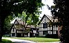 | December 13, 1978 (#78003186) | 4305 Sulgrave Rd. 37°33′11″N 77°30′18″W / 37.553056°N 77.505000°W / 37.553056; -77.505000 (Agecroft) | |
| 3 | The Almshouse |  | October 29, 1981 (#81000647) | 210 Hospital St. 37°33′11″N 77°25′50″W / 37.553056°N 77.430556°W / 37.553056; -77.430556 (The Almshouse) | |
| 4 | American Tobacco Company, South Richmond Complex Historic District |  | August 15, 2016 (#16000536) | 400-800 Jefferson Davis Highway 37°30′31″N 77°26′52″W / 37.508611°N 77.447778°W / 37.508611; -77.447778 (American Tobacco Company, South Richmond Complex Historic District) | |
| 5 | Armitage Manufacturing Company |  | August 22, 2012 (#12000545) | 3200 Williamsburg Ave. 37°31′29″N 77°24′54″W / 37.524722°N 77.415000°W / 37.524722; -77.415000 (Armitage Manufacturing Company) | |
| 6 | Atlantic Motor Company |  | November 16, 2005 (#05001271) | 1840 W. Broad St. 37°33′24″N 77°27′36″W / 37.556667°N 77.460000°W / 37.556667; -77.460000 (Atlantic Motor Company) | |
| 7 | Nathaniel Bacon School |  | August 24, 1992 (#92001031) | 815 N. 35th St. 37°31′51″N 77°24′17″W / 37.530833°N 77.404722°W / 37.530833; -77.404722 (Nathaniel Bacon School) | |
| 8 | Baker Public School |  | August 15, 2016 (#16000537) | 100 W. Baker St. 37°33′07″N 77°26′18″W / 37.551944°N 77.438333°W / 37.551944; -77.438333 (Baker Public School) | |
| 9 | Barret House |  | February 23, 1972 (#72001517) | 15 S. 5th St. 37°32′22″N 77°26′26″W / 37.539583°N 77.440417°W / 37.539583; -77.440417 (Barret House) | |
| 10 | Barton Heights Cemeteries |  | April 10, 2002 (#02000364) | 1600 Lamb Ave. 37°33′29″N 77°25′58″W / 37.558056°N 77.432778°W / 37.558056; -77.432778 (Barton Heights Cemeteries) | |
| 11 | Battery Court Historic District | 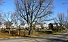 | October 9, 2003 (#02000594) | Roughly Dupont, Edgewood, Fendall, Greenwood, Griffin, Montrose, Moss Side, Noble, North, Edgehill, and Graham 37°34′02″N 77°26′23″W / 37.567222°N 77.439722°W / 37.567222; -77.439722 (Battery Court Historic District) | |
| 12 | William Beers House |  | April 16, 1969 (#69000346) | 1228 E. Broad St. 37°32′19″N 77°25′47″W / 37.538611°N 77.429722°W / 37.538611; -77.429722 (William Beers House) | |
| 13 | Belgian Building |  | February 26, 1970 (#01000439) | Lombardy St. at its junction with Brook Rd. 37°33′44″N 77°27′00″W / 37.562222°N 77.450000°W / 37.562222; -77.450000 (Belgian Building) | |
| 14 | Bell Tower |  | June 11, 1969 (#69000347) | Capitol Sq. 37°32′20″N 77°26′07″W / 37.538944°N 77.435278°W / 37.538944; -77.435278 (Bell Tower) | |
| 15 | Belle Isle |  | March 17, 1995 (#95000246) | James River at U.S. Routes 1/301 37°31′45″N 77°27′13″W / 37.529167°N 77.453611°W / 37.529167; -77.453611 (Belle Isle) | |
| 16 | Blackwell Historic District |  | March 20, 2019 (#100003544) | Roughly bounded by Decatur and E. 14th Sts., Dinwiddie Ave., and Jefferson Davis Highway 37°30′54″N 77°26′40″W / 37.515000°N 77.444444°W / 37.515000; -77.444444 (Blackwell Historic District) | |
| 17 | Blair Tobacco Storage Warehouse Complex Historic District | 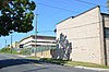 | August 15, 2016 (#16000538) | 2601 Maury St. 37°30′36″N 77°27′20″W / 37.510000°N 77.455556°W / 37.510000; -77.455556 (Blair Tobacco Storage Warehouse Complex Historic District) | |
| 18 | Block 0-100 East Franklin Street Historic District | 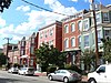 | February 27, 1980 (#80004216) | Roughly bounded by 1st, Main, Foushee, and Grace Sts. 37°32′35″N 77°26′37″W / 37.543056°N 77.443611°W / 37.543056; -77.443611 (Block 0-100 East Franklin Street Historic District) | |
| 19 | Blues Armory |  | May 17, 1976 (#76002229) | 6th and Marshall Sts. 37°32′36″N 77°26′07″W / 37.543333°N 77.435278°W / 37.543333; -77.435278 (Blues Armory) | |
| 20 | Boulevard Historic District | 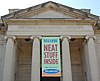 | September 18, 1986 (#86002887) | 10-300 S. Boulevard and 10-800 N. Boulevard 37°33′23″N 77°28′29″W / 37.556389°N 77.474722°W / 37.556389; -77.474722 (Boulevard Historic District) | |
| 21 | Branch Building |  | April 17, 1970 (#70000878) | 1015 E. Main St. 37°32′13″N 77°26′06″W / 37.537083°N 77.435000°W / 37.537083; -77.435000 (Branch Building) | |
| 22 | Branch House |  | February 23, 1984 (#84003569) | 2501 Monument Ave. 37°33′30″N 77°28′06″W / 37.558333°N 77.468333°W / 37.558333; -77.468333 (Branch House) | |
| 23 | Broad Street Commercial Historic District |  | April 9, 1987 (#87000611) | Along Broad St., an area roughly bounded by Belvidere, Marshall, 4th, and Grace; also 709-916 W. Broad St., 308-310 N. Laurel St., and 301-306 Gilmer St.; also the southern side of the 100 block of E. Marshall St., and the 300 blocks of 1st and 2nd Sts., between Broad and Marshall Sts. 37°32′48″N 77°26′37″W / 37.546667°N 77.443611°W / 37.546667; -77.443611 (Broad Street Commercial Historic District) | Second and third sets of boundaries represent boundary increases of August 11, 2004 and March 27, 2007 |
| 24 | Broad Street Station |  | February 23, 1972 (#72001518) | Broad and Robinson Sts. 37°33′40″N 77°27′57″W / 37.561111°N 77.465833°W / 37.561111; -77.465833 (Broad Street Station) | |
| 25 | Brookland Park Historic District |  | August 6, 2003 (#02000591) | Roughly Griffin, Fendall, Hanes, Garland, North, Barton, Lamb, and Cliff Aves., and Norwood, Hooper, Essex, and Brookland Park 37°34′20″N 77°25′57″W / 37.572222°N 77.432500°W / 37.572222; -77.432500 (Brookland Park Historic District) | |
| 26 | Joseph Bryan Park |  | November 21, 2002 (#02001369) | 4308 Hermitage Rd. 37°35′37″N 77°28′26″W / 37.593611°N 77.473889°W / 37.593611; -77.473889 (Joseph Bryan Park) | |
| 27 | Byrd Park Court Historic District |  | February 2, 2016 (#15001043) | 701, 703, and 735 Lake Rd. and 705-733 Byrd Park Ct. 37°32′37″N 77°28′16″W / 37.543611°N 77.471111°W / 37.543611; -77.471111 (Byrd Park Court Historic District) | |
| 28 | Byrd Theatre |  | September 24, 1979 (#79003289) | 2908 W. Cary St. 37°33′09″N 77°28′40″W / 37.552500°N 77.477778°W / 37.552500; -77.477778 (Byrd Theatre) | |
| 29 | William Byrd Hotel |  | December 16, 1996 (#96001454) | 2501 W. Broad St. 37°33′36″N 77°27′59″W / 37.560000°N 77.466389°W / 37.560000; -77.466389 (William Byrd Hotel) | |
| 30 | William Byrd Park |  | February 2, 2016 (#15001044) | 600 S. Boulevard 37°32′40″N 77°28′40″W / 37.544444°N 77.477778°W / 37.544444; -77.477778 (William Byrd Park) | |
| 31 | Henry Coalter Cabell House |  | December 27, 1972 (#72001519) | 116 S. 3rd St. 37°32′24″N 77°26′37″W / 37.540000°N 77.443611°W / 37.540000; -77.443611 (Henry Coalter Cabell House) | |
| 32 | Henry Mansfield Cannon Memorial Chapel |  | May 7, 2013 (#13000259) | 36 Westhampton Way 37°34′28″N 77°32′20″W / 37.574444°N 77.538889°W / 37.574444; -77.538889 (Henry Mansfield Cannon Memorial Chapel) | |
| 33 | Carillon Neighborhood Historic District |  | February 2, 2016 (#15001045) | Belmont, Blanton, Maplewood, Rendale, and Sunset Aves., and Carrolton, Condie, French, Garrett, Rueger, and Sheppard Sts. 37°32′40″N 77°29′06″W / 37.544444°N 77.485000°W / 37.544444; -77.485000 (Carillon Neighborhood Historic District) | |
| 34 | Carver Industrial Historic District |  | May 26, 2000 (#00000559) | Marshall, Lombardy, Clay, and Harrison Sts. 37°33′16″N 77°27′14″W / 37.554444°N 77.453889°W / 37.554444; -77.453889 (Carver Industrial Historic District) | |
| 35 | Carver Residential Historic District |  | April 12, 2002 (#02000365) | 700-1500 blocks of W. Leigh, the 700-1400 blocks of W. Catherine, and Clay and Marshall; also 909-1011 W. Marshall St. 37°33′10″N 77°26′58″W / 37.552778°N 77.449444°W / 37.552778; -77.449444 (Carver Residential Historic District) | W. Marshall represents a boundary increase of November 1, 2006 |
| 36 | Cary Street Park and Shop Center |  | July 5, 2001 (#01000701) | 3120-3158 W. Cary St. 37°33′14″N 77°28′53″W / 37.553889°N 77.481389°W / 37.553889; -77.481389 (Cary Street Park and Shop Center) | |
| 37 | John B. Cary School |  | August 24, 1992 (#92001030) | 2100 Idlewood Ave. 37°32′48″N 77°28′09″W / 37.546667°N 77.469167°W / 37.546667; -77.469167 (John B. Cary School) | |
| 38 | Cathedral of the Sacred Heart |  | July 8, 1982 (#82004584) | Floyd Ave. and Laurel St. 37°32′51″N 77°27′08″W / 37.547500°N 77.452222°W / 37.547500; -77.452222 (Cathedral of the Sacred Heart) | |
| 39 | Centenary Church |  | December 28, 1979 (#79003077) | 411 E. Grace St. 37°32′31″N 77°26′20″W / 37.541944°N 77.438889°W / 37.541944; -77.438889 (Centenary Church) | |
| 40 | Central National Bank |  | September 20, 1979 (#79003290) | 3rd and Broad Sts. 37°32′37″N 77°26′24″W / 37.543611°N 77.44°W / 37.543611; -77.44 (Central National Bank) | |
| 41 | Chamberlayne Gardens |  | May 2, 2007 (#07000390) | 4301-4313 and 4315-4327 Chamberlayne Ave. and 4800-4818 Old Brook Rd. 37°35′43″N 77°26′55″W / 37.595278°N 77.448611°W / 37.595278; -77.448611 (Chamberlayne Gardens) | |
| 42 | The Chesapeake Warehouses |  | April 11, 2014 (#13000891) | 1100 Dinwiddie Ave. 37°30′50″N 77°26′14″W / 37.513889°N 77.437222°W / 37.513889; -77.437222 (The Chesapeake Warehouses) | |
| 43 | Chestnut Hill-Plateau Historic District |  | April 12, 2002 (#02000366) | 1st, 2nd, 3rd, 4th, and 5th Aves. from Brooklyn Park Boulevard to Trigg St. 37°33′47″N 77°25′14″W / 37.563056°N 77.420556°W / 37.563056; -77.420556 (Chestnut Hill-Plateau Historic District) | |
| 44 | Church Hill North Historic District | 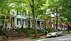 | September 5, 1997 (#97000958) | Along Marshall, Clay, Leigh, and M. Sts., bounded by 21st and 30th Sts.; also roughly bounded by 25th St., T St., 32nd St., and M St. 37°31′58″N 77°24′57″W / 37.532778°N 77.415833°W / 37.532778; -77.415833 (Church Hill North Historic District) | Second set of boundaries represents a boundary increase of August 16, 2000 |
| 45 | Church of the Sacred Heart |  | November 20, 2002 (#02001368) | 1401 Perry St. 37°31′21″N 77°26′55″W / 37.522500°N 77.448611°W / 37.522500; -77.448611 (Church of the Sacred Heart) | |
| 46 | City Hall |  | October 1, 1969 (#69000327) | Bounded by 10th, Broad, 11th, and Capitol Sts. 37°32′23″N 77°25′58″W / 37.539722°N 77.432778°W / 37.539722; -77.432778 (City Hall) | |
| 47 | Clovelly | Upload image | March 23, 2022 (#100007540) | 337 Clovelly Rd. 37°32′48″N 77°29′53″W / 37.5466°N 77.4980°W / 37.5466; -77.4980 (Clovelly) | |
| 48 | The Coliseum-Duplex Envelope Company Building | 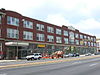 | January 27, 1999 (#99000077) | 1339-1363 W. Broad St. 37°33′12″N 77°27′20″W / 37.553333°N 77.455556°W / 37.553333; -77.455556 (The Coliseum-Duplex Envelope Company Building) | |
| 49 | Columbia | 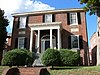 | September 16, 1982 (#82004585) | 1142 W. Grace St. 37°33′12″N 77°27′23″W / 37.553333°N 77.456389°W / 37.553333; -77.456389 (Columbia) | |
| 50 | Commonwealth Club Historic District |  | April 7, 1983 (#83003301) | 319-415 and 400-500 W. Franklin St. 37°32′46″N 77°26′52″W / 37.546111°N 77.447778°W / 37.546111; -77.447778 (Commonwealth Club Historic District) | |
| 51 | Confederate Memorial Chapel | 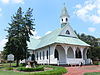 | February 23, 1972 (#72001520) | 2900 Grove Ave. 37°33′21″N 77°28′34″W / 37.555833°N 77.476111°W / 37.555833; -77.476111 (Confederate Memorial Chapel) | |
| 52 | Crenshaw House |  | August 30, 2010 (#10000585) | 919 W. Franklin St. 37°32′59″N 77°27′14″W / 37.549722°N 77.453889°W / 37.549722; -77.453889 (Crenshaw House) | |
| 53 | Crozet House | 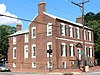 | February 23, 1972 (#72001521) | 100 E. Main St. 37°32′33″N 77°26′35″W / 37.542500°N 77.443194°W / 37.542500; -77.443194 (Crozet House) | |
| 54 | Decatur O. Davis House |  | May 11, 2000 (#00000490) | 1001 E. Clay St. 37°32′30″N 77°25′53″W / 37.541667°N 77.431389°W / 37.541667; -77.431389 (Decatur O. Davis House) | |
| 55 | Deep Run Hunt Club Rosedale Lodge |  | May 21, 2019 (#100003977) | 1900 Avondale Ave. 37°35′08″N 77°28′09″W / 37.585556°N 77.469167°W / 37.585556; -77.469167 (Deep Run Hunt Club Rosedale Lodge) | |
| 56 | Department of Public Utilities Howard (Overbrook) Road Facility |  | July 24, 2007 (#07000767) | 1307, 1311, 1315, 1317, and 1319 Overbrook Rd. 37°33′54″N 77°27′11″W / 37.565000°N 77.453056°W / 37.565000; -77.453056 (Department of Public Utilities Howard (Overbrook) Road Facility) | |
| 57 | Donnan-Asher Iron-Front Building | 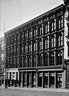 | February 26, 1970 (#70000879) | 1207-1211 E. Main St. 37°32′11″N 77°26′00″W / 37.536389°N 77.433472°W / 37.536389; -77.433472 (Donnan-Asher Iron-Front Building) | |
| 58 | Egyptian Building |  | April 16, 1969 (#69000321) | Southwestern corner of the junction of E. Marshall and College Sts. 37°32′21″N 77°25′46″W / 37.539167°N 77.429444°W / 37.539167; -77.429444 (Egyptian Building) | |
| 59 | English Village | 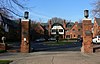 | September 29, 1983 (#83003302) | 3418-3450 Grove Ave. 37°33′31″N 77°29′02″W / 37.558611°N 77.483889°W / 37.558611; -77.483889 (English Village) | |
| 60 | Fairmount Historic District | 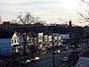 | February 19, 2008 (#08000075) | Roughly bounded by 24th, Y, 20th, T, R, Q, and P Sts., Fairfield and Carrington Aves., and the Mechanicsville Turnpike 37°32′31″N 77°24′48″W / 37.541944°N 77.413333°W / 37.541944; -77.413333 (Fairmount Historic District) | |
| 61 | Fairmount School |  | November 9, 2005 (#05001227) | 1501 N. 21st St. 37°32′37″N 77°24′45″W / 37.543611°N 77.412500°W / 37.543611; -77.412500 (Fairmount School) | |
| 62 | Fan Area Historic District |  | September 12, 1985 (#85002243) | Roughly bounded by N. Harrison, W. Main, W. Grace, and N. Mullberry Sts.; also roughly bounded by W. Main St., S. Harrison St., the Richmond Metropolitan Expressway, and S. Boulevard 37°32′56″N 77°28′08″W / 37.548889°N 77.468889°W / 37.548889; -77.468889 (Fan Area Historic District) | Second set of boundaries represents a boundary increase of May 30, 1986 |
| 63 | Fifth and Main Downtown Historic District |  | August 30, 2006 (#06000750) | 400-500 blocks of E. Franklin St., the 400-600 blocks of E. Main St., the 00 blocks of N. 4th, 5th, and 6th Sts. and S. 5th St.; also the 00 blocks of N. 3rd, N. 4th, and S. 6th, and the 300 and 400 blocks of E. Main Sts. 37°32′26″N 77°26′24″W / 37.540556°N 77.440000°W / 37.540556; -77.440000 (Fifth and Main Downtown Historic District) | Second set of boundaries represents a boundary increase of November 28, 2012 |
| 64 | First African Baptist Church |  | April 16, 1969 (#69000348) | Northeastern corner of the junction of College and E. Broad Sts. 37°32′19″N 77°25′46″W / 37.538611°N 77.429444°W / 37.538611; -77.429444 (First African Baptist Church) | |
| 65 | First Baptist Church |  | April 16, 1969 (#69000349) | Northwestern corner of the junction of 12th and E. Broad Sts. 37°32′23″N 77°25′53″W / 37.539722°N 77.431389°W / 37.539722; -77.431389 (First Baptist Church) | |
| 66 | First Battalion Virginia Volunteers Armory |  | December 23, 2009 (#09001158) | 122 W. Leigh St. 37°33′00″N 77°26′29″W / 37.550000°N 77.441389°W / 37.550000; -77.441389 (First Battalion Virginia Volunteers Armory) | |
| 67 | First National Bank Building |  | April 12, 1982 (#82004586) | 825-27 E. Main St. 37°32′17″N 77°26′12″W / 37.538056°N 77.436667°W / 37.538056; -77.436667 (First National Bank Building) | |
| 68 | Forest Hill Historic District |  | October 3, 2012 (#12000851) | Roughly bounded by Riverside Dr., Forest Hill Park, Reedy Creek, Bassett Ave., Southcliff Rd., and Cedar Ln. 37°31′08″N 77°28′48″W / 37.518889°N 77.480000°W / 37.518889; -77.480000 (Forest Hill Historic District) | |
| 69 | Forest Hill Park |  | November 22, 2002 (#02001446) | Between Riverside Dr., Forest Hill Ave., 42nd St., and 34th St. 37°31′10″N 77°28′24″W / 37.519444°N 77.473333°W / 37.519444; -77.473333 (Forest Hill Park) | |
| 70 | Fourth Baptist Church |  | September 7, 1979 (#79003291) | 2800 P St. 37°32′10″N 77°24′36″W / 37.536111°N 77.410000°W / 37.536111; -77.410000 (Fourth Baptist Church) | |
| 71 | Fraternal Order of Eagles Building |  | May 3, 2006 (#06000346) | 220 E. Marshall St. 37°32′43″N 77°26′18″W / 37.545278°N 77.438333°W / 37.545278; -77.438333 (Fraternal Order of Eagles Building) | |
| 72 | Robert Fulton School | 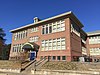 | September 18, 2017 (#100001643) | 1000-1012 Carlisle Ave. 37°31′02″N 77°24′16″W / 37.517222°N 77.404444°W / 37.517222; -77.404444 (Robert Fulton School) | |
| 73 | Ginter Park Historic District |  | September 22, 1986 (#86002688) | Roughly bounded by North Ave., Moss Side, and Hawthorne and Chamberlayne Aves., Brookland Park Boulevard, and Brook Rd.; also parts of Brook Rd. and Seminary, Chamberlayne, Montrose, Moss Side, and Noble Aves. 37°34′54″N 77°26′48″W / 37.581667°N 77.446667°W / 37.581667; -77.446667 (Ginter Park Historic District) | Second set of addresses represents a boundary increase of June 5, 2017 |
| 74 | Ginter Park Terrace Historic District |  | December 4, 2004 (#04001292) | 3000 blocks of Hawthorne, Noble, Moss Side, Montrose, and Edgewood Aves. 37°34′24″N 77°26′27″W / 37.573333°N 77.440833°W / 37.573333; -77.440833 (Ginter Park Terrace Historic District) | |
| 75 | Ellen Glasgow House | 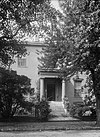 | November 11, 1971 (#71001041) | 1 W. Main St. 37°32′35″N 77°26′41″W / 37.543056°N 77.444722°W / 37.543056; -77.444722 (Ellen Glasgow House) | |
| 76 | Gordon-Baughan-Warren House |  | February 1, 2006 (#05001621) | 6303 Towana Rd. 37°34′38″N 77°31′40″W / 37.577222°N 77.527778°W / 37.577222; -77.527778 (Gordon-Baughan-Warren House) | |
| 77 | Governor's Mansion |  | June 4, 1969 (#69000360) | Capitol Sq. 37°32′18″N 77°25′56″W / 37.538333°N 77.432222°W / 37.538333; -77.432222 (Governor's Mansion) | |
| 78 | Grace Hospital | 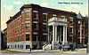 | August 11, 2004 (#04000856) | 401 W. Grace St. 37°32′49″N 77°26′48″W / 37.546944°N 77.446667°W / 37.546944; -77.446667 (Grace Hospital) | |
| 79 | Grace Street Commercial Historic District |  | July 13, 1998 (#98000739) | Roughly bounded by Adams, Broad, 8th, and Franklin Sts.; also 626 and 700 E. Broad St., 12-118 N. 8th St., 707-715 E. Franklin St., and 2-18 and 13 W. Franklin St. 37°32′32″N 77°26′19″W / 37.542222°N 77.438611°W / 37.542222; -77.438611 (Grace Street Commercial Historic District) | Second set of boundaries represents a boundary increase of November 12, 2009 |
| 80 | William H. Grant House |  | April 16, 1969 (#69000356) | 1008 E. Clay St. 37°32′31″N 77°25′51″W / 37.541944°N 77.430833°W / 37.541944; -77.430833 (William H. Grant House) | |
| 81 | Elliott Grays Marker-Jefferson Davis Highway | 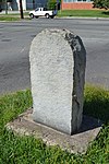 | August 31, 2006 (#06000748) | Junction of Harwood St., Ingram Ave., and the Jefferson Davis Highway 37°30′12″N 77°26′48″W / 37.503361°N 77.446639°W / 37.503361; -77.446639 (Elliott Grays Marker-Jefferson Davis Highway) | |
| 82 | General Outdoor Advertising Company Richmond Branch |  | April 15, 2019 (#100003615) | 1000 Jefferson Davis Highway 37°30′22″N 77°26′52″W / 37.506111°N 77.447639°W / 37.506111; -77.447639 (General Outdoor Advertising Company Richmond Branch) | |
| 83 | Green's Farm (Huntley) |  | November 9, 2005 (#05001228) | 6510 Three Chopt Rd. 37°34′57″N 77°31′46″W / 37.582500°N 77.529444°W / 37.582500; -77.529444 (Green's Farm (Huntley)) | |
| 84 | Hancock-Wirt-Caskie House | 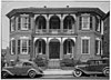 | April 17, 1970 (#70000881) | 2 N. 5th St. 37°32′26″N 77°26′24″W / 37.540556°N 77.440000°W / 37.540556; -77.440000 (Hancock-Wirt-Caskie House) | |
| 85 | Hasker and Marcuse Factory |  | August 11, 1983 (#83003303) | 2401-2413 Venable St. 37°32′18″N 77°24′51″W / 37.538333°N 77.414167°W / 37.538333; -77.414167 (Hasker and Marcuse Factory) | |
| 86 | Bolling Haxall House |  | March 16, 1972 (#72001522) | 211 E. Franklin St. 37°32′32″N 77°26′29″W / 37.542222°N 77.441389°W / 37.542222; -77.441389 (Bolling Haxall House) | |
| 87 | Hebrew Cemetery |  | May 5, 2006 (#06000348) | 400 Hospital St. 37°33′09″N 77°25′47″W / 37.552500°N 77.429722°W / 37.552500; -77.429722 (Hebrew Cemetery) | |
| 88 | Hermitage Road Historic District | 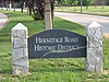 | February 9, 2006 (#06000031) | 3800-4200 blocks of Hermitage Rd. 37°35′20″N 77°27′50″W / 37.588889°N 77.463889°W / 37.588889; -77.463889 (Hermitage Road Historic District) | |
| 89 | Hermitage Road Warehouse Historic District |  | June 9, 2014 (#14000302) | Bounded by Hermitage and Overbrook Rds., Sherwood Ave., and Interstate 95; also Hermitage Rd., 1700 blk. of Rhoadmiller St. 37°34′07″N 77°27′32″W / 37.568611°N 77.458889°W / 37.568611; -77.458889 (Hermitage Road Warehouse Historic District) | Boundary increase approved October 5, 2023 |
| 90 | Higgins Doctors Office Building |  | May 8, 2017 (#100000987) | 3540 Floyd Ave. 37°33′30″N 77°29′14″W / 37.558472°N 77.487222°W / 37.558472; -77.487222 (Higgins Doctors Office Building) | |
| 91 | High-Rise for the Elderly | Upload image | February 6, 2024 (#100009501) | 1202 N. 1st Street 37°33′12″N 77°26′01″W / 37.5532°N 77.4336°W / 37.5532; -77.4336 (High-Rise for the Elderly) | |
| 92 | Highland Park Plaza Historic District |  | December 4, 2004 (#04001294) | Roughly bounded by Meadowbridge Rd., Missouri Ave., the city limits, and Detroit Ave. 37°34′29″N 77°24′58″W / 37.574722°N 77.416111°W / 37.574722; -77.416111 (Highland Park Plaza Historic District) | |
| 93 | Highland Park Public School |  | October 22, 1991 (#91001683) | 2928 2nd Ave. 37°34′10″N 77°25′09″W / 37.569444°N 77.419167°W / 37.569444; -77.419167 (Highland Park Public School) | |
| 94 | Holly Lawn |  | August 26, 1982 (#82004587) | 4015 Hermitage Rd. 37°35′22″N 77°27′48″W / 37.589306°N 77.463333°W / 37.589306; -77.463333 (Holly Lawn) | |
| 95 | Holly Springs Apartments |  | November 18, 2019 (#100004649) | 801 Holly Springs Ave. 37°30′11″N 77°27′40″W / 37.503056°N 77.461111°W / 37.503056; -77.461111 (Holly Springs Apartments) | |
| 96 | Hollywood Cemetery |  | November 12, 1969 (#69000350) | 412 S. Cherry St. 37°32′10″N 77°27′30″W / 37.536111°N 77.458333°W / 37.536111; -77.458333 (Hollywood Cemetery) | |
| 97 | Home For Confederate Women | 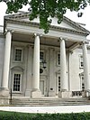 | November 7, 1985 (#85002767) | 301 N. Sheppard St. 37°33′25″N 77°28′34″W / 37.556944°N 77.476111°W / 37.556944; -77.476111 (Home For Confederate Women) | |
| 98 | Hunt-Sitterding House |  | September 12, 2008 (#08000877) | 901 Floyd Ave. 37°32′49″N 77°27′11″W / 37.5469°N 77.4531°W / 37.5469; -77.4531 (Hunt-Sitterding House) | |
| 99 | Jackson Ward Historic District |  | July 30, 1976 (#76002187) | Roughly bounded by 5th, Marshall, and Gilmer Sts., and the Richmond-Petersburg Turnpike; also ½-17 E. Marshall St. and 0-24 W. Marshall St.; also the 400 blocks of 1st, 2nd, and 3rd Sts., 106-108 E. Marshall, and 411-413 N. Adams St. 37°32′52″N 77°26′28″W / 37.547778°N 77.441111°W / 37.547778; -77.441111 (Jackson Ward Historic District) | Second and third sets of boundaries represent boundary increases of September 26, 2005 and May 16, 2008 |
| 100 | James River and Kanawha Canal Historic District |  | August 26, 1971 (#71000982) | Extends from Ship Locks to Bosher's Dam 37°32′06″N 77°26′36″W / 37.535000°N 77.443333°W / 37.535000; -77.443333 (James River and Kanawha Canal Historic District) | |
| 101 | Jefferson Hotel | 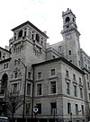 | June 4, 1969 (#69000351) | 104 W. Main St. 37°32′39″N 77°26′44″W / 37.544167°N 77.445556°W / 37.544167; -77.445556 (Jefferson Hotel) | |
| 102 | Jerman House |  | February 2, 2016 (#15001046) | 24 Hampton Hills Ln. 37°33′53″N 77°31′36″W / 37.564722°N 77.526667°W / 37.564722; -77.526667 (Jerman House) | |
| 103 | John Rolfe Apartments | 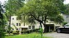 | September 9, 2010 (#10000736) | 101 Tempsford Ln. 37°33′59″N 77°31′11″W / 37.566389°N 77.519722°W / 37.566389; -77.519722 (John Rolfe Apartments) | |
| 104 | Kent Road Village |  | August 18, 2011 (#11000549) | 920-924 N. Hamilton St. and 905-935 Kent Rd. 37°33′59″N 77°29′03″W / 37.566389°N 77.484167°W / 37.566389; -77.484167 (Kent Road Village) | |
| 105 | Kent-Valentine House |  | December 18, 1970 (#70000882) | 12 E. Franklin St. 37°32′38″N 77°26′34″W / 37.543889°N 77.442778°W / 37.543889; -77.442778 (Kent-Valentine House) | |
| 106 | Kenwyn |  | June 1, 2018 (#100002530) | 6 Ampthill Rd. 37°33′59″N 77°30′52″W / 37.566250°N 77.514444°W / 37.566250; -77.514444 (Kenwyn) | |
| 107 | Laburnum Park Historic District |  | February 5, 2002 (#01001573) | Westwood, Palmyra, Confederate, Wilmington, and W. Laburnum Aves., and Chatham, Gloucester, and Lamont Sts. 37°34′52″N 77°27′23″W / 37.581111°N 77.456389°W / 37.581111; -77.456389 (Laburnum Park Historic District) | |
| 108 | Laurel Meadow |  | February 5, 2014 (#13001165) | 1640 Bramwell Rd. 37°29′08″N 77°30′27″W / 37.485556°N 77.507500°W / 37.485556; -77.507500 (Laurel Meadow) | |
| 109 | Lee Medical Building | 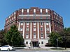 | April 17, 2018 (#100002356) | 1805 Monument Ave. 37°33′14″N 77°27′39″W / 37.553889°N 77.460833°W / 37.553889; -77.460833 (Lee Medical Building) | |
| 110 | Robert E. Lee Monument |  | January 5, 2007 (#06001213) | 1700 Monument Ave. at the junction of Monument and Allen Aves. 37°33′14″N 77°27′36″W / 37.553889°N 77.460000°W / 37.553889; -77.460000 (Robert E. Lee Monument) | |
| 111 | Leigh Street Baptist Church |  | March 16, 1972 (#72001523) | 517 N. 25th St. 37°32′02″N 77°24′58″W / 37.533889°N 77.416111°W / 37.533889; -77.416111 (Leigh Street Baptist Church) | |
| 112 | Benjamin Watkins Leigh House | 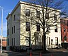 | April 16, 1969 (#69000352) | 1000 E. Clay St. 37°32′31″N 77°25′52″W / 37.542083°N 77.431111°W / 37.542083; -77.431111 (Benjamin Watkins Leigh House) | |
| 113 | Linden Row |  | November 23, 1971 (#71001061) | 100-114 E. Franklin St. 37°32′36″N 77°26′32″W / 37.543333°N 77.442222°W / 37.543333; -77.442222 (Linden Row) | |
| 114 | Loews Theatre |  | November 20, 1979 (#79003292) | 6th and Grace Sts. 37°32′30″N 77°26′13″W / 37.541667°N 77.436944°W / 37.541667; -77.436944 (Loews Theatre) | |
| 115 | Main Street Banking Historic District |  | June 1, 2005 (#05000527) | E. Main St. between 7th and Governors Sts.; also 700, 703, 705-711, 801, and 830-838 Main St., E., 7 7th St., S., and 28 6th St., S. 37°32′18″N 77°26′10″W / 37.538333°N 77.436111°W / 37.538333; -77.436111 (Main Street Banking Historic District) | Second set of boundaries represents a boundary increase of August 27, 2013 |
| 116 | Main Street Station and Trainshed |  | October 15, 1970 (#70000867) | 1020 E. Main St. 37°32′05″N 77°25′45″W / 37.534722°N 77.429167°W / 37.534722; -77.429167 (Main Street Station and Trainshed) | |
| 117 | Manchester Courthouse |  | May 8, 1998 (#98000450) | 920 Hull St. 37°31′19″N 77°26′31″W / 37.521944°N 77.441944°W / 37.521944; -77.441944 (Manchester Courthouse) | |
| 118 | Manchester Industrial Historic District |  | August 2, 2000 (#00000886) | Roughly bounded by Perry St., the James River, Mayo's Bridge, Maury St., and 10th St.; also the 700 block of Stockton St.; also parts of Decatur, Everett, Hull, Maury, and Stockton Sts., 700 Semmes Ave., 300 E. 2nd St., and the 300 blocks of E. 5th and 6th Sts. 37°31′33″N 77°26′13″W / 37.525833°N 77.436944°W / 37.525833; -77.436944 (Manchester Industrial Historic District) | Second and third sets of boundaries represent boundary increases of September 22, 2004 and August 1, 2012 |
| 119 | Manchester Residential and Commercial Historic District |  | May 16, 2002 (#02000521) | Roughly bounded by 9th St., McDonough St., Cowardin Ave., and Stockton St.; also 1211-1217, 1301-1305, and 1418 McDonough St., 310-312 W. 12th St., 309 W. 13th St., and 314 and 400 W. 14th St.; also along Semmes Ave., Cowardin St., and Jefferson Davis Highway 37°31′21″N 77°26′42″W / 37.522500°N 77.445000°W / 37.522500; -77.445000 (Manchester Residential and Commercial Historic District) | Additional boundaries represent increases approved November 1, 2006 and December 20, 2018 |
| 120 | Manchester Trucking and Commercial Historic District | Upload image | May 3, 2019 (#100003965) | Primarily along Commerce Rd. and Gordon and Dinwiddie Aves. 37°30′46″N 77°25′59″W / 37.512778°N 77.433056°W / 37.512778; -77.433056 (Manchester Trucking and Commercial Historic District) | |
| 121 | John Marshall House |  | October 15, 1966 (#66000916) | 9th and Marshall Sts. 37°32′31″N 77°25′59″W / 37.541944°N 77.433056°W / 37.541944; -77.433056 (John Marshall House) | |
| 122 | Mason's Hall |  | July 2, 1973 (#73002220) | 1807 E. Franklin St. 37°32′00″N 77°25′36″W / 37.533472°N 77.426667°W / 37.533472; -77.426667 (Mason's Hall) | |
| 123 | Masonic Temple | 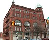 | February 10, 1983 (#83003305) | 101-107 W. Broad St. 37°32′46″N 77°26′36″W / 37.546111°N 77.443333°W / 37.546111; -77.443333 (Masonic Temple) | |
| 124 | Maury Street Marker, Jefferson Davis Highway |  | June 2, 2004 (#04000572) | Junction of Maury St. and the Jefferson Davis Highway 37°30′45″N 77°26′53″W / 37.512583°N 77.448111°W / 37.512583; -77.448111 (Maury Street Marker, Jefferson Davis Highway) | |
| 125 | Maymont |  | December 16, 1971 (#71001062) | Hampton St. (Spottswood Rd.) 37°32′04″N 77°28′42″W / 37.534444°N 77.478333°W / 37.534444; -77.478333 (Maymont) | |
| 126 | Milburne |  | April 15, 2019 (#100003616) | 315 Lock Ln. 37°33′14″N 77°30′38″W / 37.553889°N 77.510556°W / 37.553889; -77.510556 (Milburne) | |
| 127 | Model Tobacco Factory |  | April 15, 2019 (#100003617) | 1100 Jefferson Davis Highway 37°30′18″N 77°26′51″W / 37.505000°N 77.447500°W / 37.505000; -77.447500 (Model Tobacco Factory) | |
| 128 | Monroe Park Historic District |  | July 5, 1984 (#84003572) | Roughly bounded by Belvidere, Main, Cherry, Park, Laurel, and Franklin Sts. 37°32′48″N 77°27′01″W / 37.546667°N 77.450278°W / 37.546667; -77.450278 (Monroe Park Historic District) | |
| 129 | Monroe Ward | | January 27, 2000 (#99001717) | Roughly Main and Cary St., and 3rd to Jefferson Sts. 37°32′34″N 77°26′38″W / 37.542778°N 77.443889°W / 37.542778; -77.443889 (Monroe Ward) | |
| 130 | James Monroe Tomb |  | November 11, 1971 (#71001044) | Hollywood Cemetery, 412 S. Cherry St. 37°32′02″N 77°27′24″W / 37.533778°N 77.456556°W / 37.533778; -77.456556 (James Monroe Tomb) | |
| 131 | Monument Avenue Historic District |  | February 16, 1970 (#70000883) | Bounded by Grace and Birch Sts., Park Ave., and Roseneath Rd.; also roughly Franklin St. from Roseneath Rd. to Cleveland St. 37°33′30″N 77°28′04″W / 37.558333°N 77.467778°W / 37.558333; -77.467778 (Monument Avenue Historic District) | Franklin Street represents a boundary increase of January 17, 1991 |
| 132 | Monumental Church |  | April 16, 1969 (#69000326) | 1224 E. Broad St. 37°32′20″N 77°25′47″W / 37.538889°N 77.429722°W / 37.538889; -77.429722 (Monumental Church) | |
| 133 | Moore's Auto Body and Paint Shop |  | October 14, 1993 (#93001123) | 401 W. Broad St. 37°32′51″N 77°26′45″W / 37.547500°N 77.445833°W / 37.547500; -77.445833 (Moore's Auto Body and Paint Shop) | |
| 134 | Philip Morris Blended Leaf Complex Historic District |  | June 5, 2017 (#100001049) | 2301 Maury St. 37°30′46″N 77°27′00″W / 37.512778°N 77.450000°W / 37.512778; -77.450000 (Philip Morris Blended Leaf Complex Historic District) | |
| 135 | Morson's Row |  | June 11, 1969 (#69000354) | 219-223 Governor St. 37°32′19″N 77°25′54″W / 37.538611°N 77.431667°W / 37.538611; -77.431667 (Morson's Row) | |
| 136 | National Theater |  | April 2, 2003 (#03000188) | 700-710 E. Broad St. 37°32′31″N 77°26′07″W / 37.541944°N 77.435278°W / 37.541944; -77.435278 (National Theater) | |
| 137 | New Pump-House |  | November 21, 2002 (#02001366) | 1708 Pump House Dr. 37°32′12″N 77°29′10″W / 37.536667°N 77.486111°W / 37.536667; -77.486111 (New Pump-House) | |
| 138 | Ninth Street Office Building |  | September 16, 2009 (#09000730) | 202 N. 9th St. 37°32′25″N 77°26′05″W / 37.540278°N 77.434722°W / 37.540278; -77.434722 (Ninth Street Office Building) | |
| 139 | North Court |  | May 7, 2013 (#13000260) | 40 Westhampton Way 37°34′33″N 77°32′36″W / 37.57586°N 77.54342°W / 37.57586; -77.54342 (North Court) | |
| 140 | North Thompson Street Historic District |  | September 18, 2017 (#100001644) | N. Thompson St. between Broad St. and Monument Ave. 37°34′03″N 77°28′46″W / 37.567500°N 77.479444°W / 37.567500; -77.479444 (North Thompson Street Historic District) | |
| 141 | Oakwood-Chimborazo Historic District |  | March 18, 2005 (#04001372) | Roughly N. 30th-N. 39th St. on Chimborazo, Meldon, Oakwood, E. Broad, Briel, E. Clay, E. Leigh, M, E. Marshall, N, O, and P Sts. 37°31′48″N 77°24′27″W / 37.530000°N 77.407500°W / 37.530000; -77.407500 (Oakwood-Chimborazo Historic District) | |
| 142 | Old Stone House |  | November 14, 1973 (#73002222) | 1914 E. Main St. 37°31′56″N 77°25′34″W / 37.532111°N 77.426111°W / 37.532111; -77.426111 (Old Stone House) | |
| 143 | Oliver Chilled Plow Works Branch House |  | June 4, 2018 (#100002531) | 908 Oliver Way 37°32′30″N 77°25′29″W / 37.541694°N 77.424722°W / 37.541694; -77.424722 (Oliver Chilled Plow Works Branch House) | |
| 144 | Oregon Hill Historic District |  | February 5, 1991 (#91000022) | Roughly bounded by W. Cary St., Belvidere St., Oregon Hill Park, S. Cherry St. and S. Linden St. 37°32′24″N 77°27′07″W / 37.540000°N 77.451944°W / 37.540000; -77.451944 (Oregon Hill Historic District) | |
| 145 | Pace-King House |  | July 30, 1976 (#76002230) | 205 N. 19th St. 37°32′04″N 77°25′28″W / 37.534306°N 77.424444°W / 37.534306; -77.424444 (Pace-King House) | |
| 146 | Pine Camp Tuberculosis Hospital |  | April 4, 2003 (#03000190) | 4901 Old Brook Rd. 37°36′00″N 77°26′46″W / 37.600000°N 77.446111°W / 37.600000; -77.446111 (Pine Camp Tuberculosis Hospital) | |
| 147 | Planters National Bank |  | February 10, 1983 (#83003306) | 12th and E. Main Sts. 37°32′13″N 77°26′00″W / 37.536944°N 77.433333°W / 37.536944; -77.433333 (Planters National Bank) | |
| 148 | Putney Houses |  | June 11, 1969 (#69000355) | 1010-1012 E. Marshall St. 37°32′27″N 77°25′53″W / 37.540833°N 77.431389°W / 37.540833; -77.431389 (Putney Houses) | |
| 149 | Randolph School | 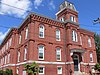 | October 4, 1984 (#84000050) | 300 S. Randolph St. 37°32′37″N 77°27′36″W / 37.543611°N 77.460000°W / 37.543611; -77.460000 (Randolph School) | |
| 150 | Reveille |  | February 1, 1979 (#79003293) | 4200 Cary St. Rd. 37°33′38″N 77°29′45″W / 37.560694°N 77.495833°W / 37.560694; -77.495833 (Reveille) | |
| 151 | Rice House |  | March 30, 1999 (#99000369) | 1000 Old Locke Lane 37°33′21″N 77°31′02″W / 37.555833°N 77.517222°W / 37.555833; -77.517222 (Rice House) | |
| 152 | Richmond Academy of Medicine |  | August 16, 1984 (#84003574) | 1200 E. Clay St. 37°32′28″N 77°25′46″W / 37.541111°N 77.429306°W / 37.541111; -77.429306 (Richmond Academy of Medicine) | |
| 153 | Richmond and Chesapeake Bay Railway Car Barn |  | May 4, 2006 (#06000349) | 1620 Brook Rd. 37°33′30″N 77°26′48″W / 37.558333°N 77.446667°W / 37.558333; -77.446667 (Richmond and Chesapeake Bay Railway Car Barn) | |
| 154 | Richmond Locomotive and Machine Works |  | April 27, 2007 (#07000363) | 1331 N. Boulevard 37°34′02″N 77°28′02″W / 37.567222°N 77.467222°W / 37.567222; -77.467222 (Richmond Locomotive and Machine Works) | |
| 155 | Robinson House |  | December 24, 2013 (#13000993) | 200 N. Boulevard 37°33′26″N 77°28′28″W / 37.557111°N 77.474472°W / 37.557111; -77.474472 (Robinson House) | |
| 156 | Rockfalls |  | February 21, 2017 (#100000678) | 7441 Rockfalls Dr. 37°33′00″N 77°31′31″W / 37.550000°N 77.525278°W / 37.550000; -77.525278 (Rockfalls) | |
| 157 | Ryland Hall |  | May 7, 2013 (#13000261) | 2 Ryland Circle 37°34′39″N 77°32′14″W / 37.577500°N 77.537222°W / 37.577500; -77.537222 (Ryland Hall) | |
| 158 | St. Alban's Hall |  | September 9, 1982 (#82004588) | 300-302 E. Main St. 37°32′29″N 77°26′29″W / 37.541389°N 77.441389°W / 37.541389; -77.441389 (St. Alban's Hall) | |
| 159 | St. Andrew's Church |  | June 22, 1979 (#79003294) | 223, 224, and 227 S. Cherry St. 37°32′31″N 77°27′07″W / 37.541944°N 77.451944°W / 37.541944; -77.451944 (St. Andrew's Church) | |
| 160 | St. Catherine's School |  | May 4, 2007 (#07000400) | 6001 Grove Ave. 37°34′20″N 77°31′16″W / 37.572222°N 77.521111°W / 37.572222; -77.521111 (St. Catherine's School) | |
| 161 | St. Christopher's School |  | March 13, 2002 (#02000183) | 711 St. Christopher's Rd. 37°34′46″N 77°31′18″W / 37.579444°N 77.521667°W / 37.579444; -77.521667 (St. Christopher's School) | |
| 162 | St. John's Church Historic District |  | September 15, 1970 (#70000884) | Bounded roughly by 22nd, Marshall, 32nd, Main, and Franklin Sts. and Williamsburg Ave.; also roughly bounded by 21st, E. Marshall, 22nd and E. Franklin Sts. 37°31′48″N 77°25′06″W / 37.530000°N 77.418333°W / 37.530000; -77.418333 (St. John's Church Historic District) | Second set of boundaries represents a boundary increase of January 17, 1991 |
| 163 | St. John's Episcopal Church |  | October 15, 1966 (#66000920) | E. Broad St. between 24th and 25th Sts. 37°31′53″N 77°25′11″W / 37.531389°N 77.419722°W / 37.531389; -77.419722 (St. John's Episcopal Church) | |
| 164 | St. Luke Building |  | September 16, 1982 (#82004589) | 900 St. James St. 37°33′04″N 77°26′13″W / 37.551111°N 77.436944°W / 37.551111; -77.436944 (St. Luke Building) | |
| 165 | St. Paul's Church |  | June 4, 1969 (#69000357) | 815 E. Grace St. 37°32′23″N 77°26′07″W / 37.539722°N 77.435278°W / 37.539722; -77.435278 (St. Paul's Church) | |
| 166 | St. Peter's Church |  | June 23, 1969 (#69000358) | 800 E. Grace St. 37°32′26″N 77°26′07″W / 37.540556°N 77.435306°W / 37.540556; -77.435306 (St. Peter's Church) | |
| 167 | St. Sophia Home of the Little Sisters of the Poor |  | May 7, 1980 (#80004217) | 16 N. Harvie St. 37°32′50″N 77°27′31″W / 37.547222°N 77.458611°W / 37.547222; -77.458611 (St. Sophia Home of the Little Sisters of the Poor) | |
| 168 | Scott House |  | November 26, 2007 (#05001545) | 909 W. Franklin St. 37°32′58″N 77°27′12″W / 37.549444°N 77.453333°W / 37.549444; -77.453333 (Scott House) | |
| 169 | Scott's Addition Historic District |  | August 12, 2005 (#05000896) | Roughly bounded by Cutshaw Ave., Boulevard, and the former Richmond, Fredericksburg and Potomac railroad line 37°34′06″N 77°28′21″W / 37.568333°N 77.4725°W / 37.568333; -77.4725 (Scott's Addition Historic District) | |
| 170 | Second Presbyterian Church |  | March 29, 1972 (#72001525) | 9 N. 5th St. 37°32′26″N 77°26′22″W / 37.540556°N 77.439444°W / 37.540556; -77.439444 (Second Presbyterian Church) | |
| 171 | Shockoe Hill Burying Ground Historic District |  | June 16, 2022 (#100007793) | Bounded by 2nd St., northern limit of CSX right-of-way (now the northern limit of the Virginia Passenger Rail Authority), historic property line and former stream courses. 37°33′05″N 77°25′46″W / 37.5514°N 77.4294°W / 37.5514; -77.4294 (Shockoe Hill Burying Ground Historic District) | The historic district includes the Shockoe Hill African Burying Ground, the City Hospital / Colored Alms House, Powder Magazine, as well as the formerly listed Shockoe Hill Cemetery, Hebrew Cemetery, and Alms House. |
| 172 | Shockoe Hill Cemetery |  | July 7, 1995 (#95000818) | Junction of Hospital and 2nd Sts. 37°33′05″N 77°25′56″W / 37.551389°N 77.432222°W / 37.551389; -77.432222 (Shockoe Hill Cemetery) | |
| 173 | Shockoe Slip Historic District |  | March 29, 1972 (#72001526) | Roughly along E. Carey St. between S. 14th and S. 12th Sts.; also roughly bounded by the former Seaboard Coast Line railroad tracks, the Downtown Expressway, Main, Dock, and 12th Sts.; also 11-15 and 101 S. 15th St., and 1433 E. Main St.; also the 300 block of S. 11th, 1200 and 1300 E. Byrd Sts., 1201 Haxall Pt., and the Thirteenth Street Bridge 37°32′07″N 77°26′02″W / 37.535278°N 77.433889°W / 37.535278; -77.433889 (Shockoe Slip Historic District) | Second, third, and fourth sets of boundaries represent boundary increases of April 20, 1983, August 24, 2005, and August 14, 2012 |
| 174 | Shockoe Valley and Tobacco Row Historic District | 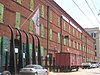 | February 24, 1983 (#83003308) | Roughly bounded by Dock, 15th, Clay, Franklin, and Peach Sts. 37°31′56″N 77°25′35″W / 37.532222°N 77.426389°W / 37.532222; -77.426389 (Shockoe Valley and Tobacco Row Historic District) | |
| 175 | Sixth Mount Zion Baptist Church |  | December 16, 1996 (#96001445) | 14 W. Duval St. 37°33′02″N 77°26′18″W / 37.550556°N 77.438333°W / 37.550556; -77.438333 (Sixth Mount Zion Baptist Church) | |
| 176 | Southern Biscuit Company |  | August 22, 2012 (#12000546) | 900 Terminal Pl. 37°33′47″N 77°28′04″W / 37.563056°N 77.467778°W / 37.563056; -77.467778 (Southern Biscuit Company) | |
| 177 | Southern Stove Works | 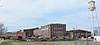 | May 26, 2005 (#05000480) | 1215 Hermitage Rd. 37°33′41″N 77°27′34″W / 37.561389°N 77.459444°W / 37.561389; -77.459444 (Southern Stove Works) | |
| 178 | Southern Stove Works, Manchester |  | February 21, 2008 (#08000076) | 516-520 Dinwiddie Ave. 37°31′04″N 77°25′57″W / 37.517778°N 77.4325°W / 37.517778; -77.4325 (Southern Stove Works, Manchester) | |
| 179 | Springfield School | 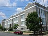 | August 24, 1992 (#92001032) | 608 N. 26th St. 37°32′03″N 77°24′55″W / 37.534167°N 77.415278°W / 37.534167; -77.415278 (Springfield School) | |
| 180 | Springhill Historic District |  | February 10, 2014 (#13001173) | W. 19th, W. 20th, W. 21st, and W. 22nd Sts., Riverside Dr., and Stonewall Ave. 37°31′24″N 77°27′16″W / 37.523333°N 77.454500°W / 37.523333; -77.454500 (Springhill Historic District) | |
| 181 | Steamer Company Number 5 |  | February 8, 1995 (#95000027) | 200 W. Marshall St. 37°32′52″N 77°26′34″W / 37.547778°N 77.442778°W / 37.547778; -77.442778 (Steamer Company Number 5) | |
| 182 | Stearns Iron-Front Building |  | February 26, 1970 (#70000885) | 1007-1013 E. Main St. 37°32′14″N 77°26′06″W / 37.537222°N 77.435000°W / 37.537222; -77.435000 (Stearns Iron-Front Building) | |
| 183 | Stewart-Lee House |  | May 5, 1972 (#72001527) | 707 E. Franklin St. 37°32′23″N 77°26′13″W / 37.539722°N 77.437083°W / 37.539722; -77.437083 (Stewart-Lee House) | |
| 184 | Stonewall Jackson School | 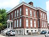 | May 3, 1984 (#84003576) | 1520 W. Main St. 37°32′51″N 77°27′38″W / 37.547500°N 77.460556°W / 37.547500; -77.460556 (Stonewall Jackson School) | |
| 185 | Taylor Farm |  | January 24, 1991 (#90002158) | 4012 Walmsley Boulevard 37°28′10″N 77°28′10″W / 37.469583°N 77.469444°W / 37.469583; -77.469444 (Taylor Farm) | |
| 186 | Taylor-Mayo House |  | April 2, 1973 (#73002221) | 110 W. Franklin St. 37°32′42″N 77°26′42″W / 37.545000°N 77.445000°W / 37.545000; -77.445000 (Taylor-Mayo House) | |
| 187 | Third Street Bethel A.M.E. Church |  | June 5, 1975 (#75002117) | 616 N. 3rd St.; also 610-614 N. 3rd St. 37°32′52″N 77°26′10″W / 37.547778°N 77.436111°W / 37.547778; -77.436111 (Third Street Bethel A.M.E. Church) | 610-614 3rd represents a boundary increase of August 7, 2019 |
| 188 | Thomas Jefferson High School |  | December 23, 1993 (#93001441) | 4100 W. Grace St. 37°34′17″N 77°29′11″W / 37.571389°N 77.486389°W / 37.571389; -77.486389 (Thomas Jefferson High School) | |
| 189 | Three Chopt Road Historic District |  | August 14, 2012 (#12000520) | Three Chopt Rd. from Cary St. to Bandy Rd. 37°34′43″N 77°31′36″W / 37.578611°N 77.526667°W / 37.578611; -77.526667 (Three Chopt Road Historic District) | |
| 190 | E. M. Todd Company |  | September 14, 2002 (#02000997) | 1128 Hermitage Rd. 37°33′44″N 77°27′38″W / 37.562222°N 77.460556°W / 37.562222; -77.460556 (E. M. Todd Company) | |
| 191 | Tower Building |  | November 24, 2017 (#100001854) | 3212 Cutshaw Ave. 37°33′57″N 77°28′32″W / 37.565833°N 77.475556°W / 37.565833; -77.475556 (Tower Building) | |
| 192 | Town of Barton Heights Historic District |  | August 6, 2003 (#02000592) | Roughly Barton, Fendall, Greenwood, Lamb, Miller, Monterio, North, Rose, Dove, Home, Minor, Poe, Wellford, and Wickham 37°33′37″N 77°25′57″W / 37.560278°N 77.4325°W / 37.560278; -77.4325 (Town of Barton Heights Historic District) | |
| 193 | Tredegar Iron Works |  | July 2, 1971 (#71001048) | 500 Tredegar St. 37°32′08″N 77°26′43″W / 37.535556°N 77.445278°W / 37.535556; -77.445278 (Tredegar Iron Works) | |
| 194 | Trinity Methodist Church |  | April 16, 1987 (#87000625) | 2000 E. Broad St. 37°32′04″N 77°25′23″W / 37.534444°N 77.423056°W / 37.534444; -77.423056 (Trinity Methodist Church) | |
| 195 | Tuckahoe Apartments |  | February 2, 2001 (#01000065) | 5621 Cary St. Rd. 37°34′07″N 77°31′22″W / 37.568611°N 77.522778°W / 37.568611; -77.522778 (Tuckahoe Apartments) | |
| 196 | Two Hundred Block West Franklin Street Historic District |  | November 17, 1977 (#77001536) | 200 block of W. Franklin St.; also 212-220 W. Main St. 37°32′43″N 77°26′45″W / 37.545278°N 77.445833°W / 37.545278; -77.445833 (Two Hundred Block West Franklin Street Historic District) | Main Street represents a boundary increase of October 21, 1994 |
| 197 | U.S. Post Office and Customhouse |  | June 4, 1969 (#69000359) | 1000 E. Main St. 37°32′16″N 77°26′05″W / 37.537778°N 77.434722°W / 37.537778; -77.434722 (U.S. Post Office and Customhouse) | |
| 198 | Union Hill Historic District |  | December 31, 2002 (#02001670) | Roughly 20th, 21st, 22nd, 23rd, 24th 25th, Jessamine, Pink, Burton, Carrington, Cedar, Clay, Jefferson, Leigh, M, and O Sts. 37°32′14″N 77°25′05″W / 37.537222°N 77.418056°W / 37.537222; -77.418056 (Union Hill Historic District) | |
| 199 | Union Seminary |  | April 14, 1983 (#83003309) | 3401 Brook Rd. 37°34′44″N 77°26′50″W / 37.578889°N 77.447222°W / 37.578889; -77.447222 (Union Seminary) | |
| 200 | United Daughters of the Confederacy Memorial Building |  | April 24, 2008 (#08000341) | 328 N. Boulevard 37°33′25″N 77°28′26″W / 37.556944°N 77.473889°W / 37.556944; -77.473889 (United Daughters of the Confederacy Memorial Building) | |
| 201 | Valentine Museum |  | June 11, 1969 (#69000329) | 1005-1015 E. Clay St. 37°32′29″N 77°25′51″W / 37.541389°N 77.430833°W / 37.541389; -77.430833 (Valentine Museum) | |
| 202 | Virginia Commission for the Blind |  | November 22, 2016 (#16000800) | 3003 Parkwood Ave. 37°33′06″N 77°28′47″W / 37.551667°N 77.479722°W / 37.551667; -77.479722 (Virginia Commission for the Blind) | |
| 203 | Virginia Department of Highways Building |  | April 5, 2004 (#04000270) | 1401 E. Broad St. 37°32′17″N 77°25′51″W / 37.538056°N 77.430833°W / 37.538056; -77.430833 (Virginia Department of Highways Building) | |
| 204 | Virginia House |  | June 13, 1990 (#89001933) | 4301 Sulgrave Rd. 37°33′13″N 77°30′11″W / 37.553611°N 77.503056°W / 37.553611; -77.503056 (Virginia House) | |
| 205 | Virginia Mutual Building |  | November 7, 1977 (#77001537) | 821 E. Main St. 37°32′18″N 77°26′13″W / 37.538333°N 77.436944°W / 37.538333; -77.436944 (Virginia Mutual Building) | |
| 206 | Virginia State Capitol |  | October 15, 1966 (#66000911) | Capitol Sq. 37°32′19″N 77°26′01″W / 37.538611°N 77.433611°W / 37.538611; -77.433611 (Virginia State Capitol) | |
| 207 | Virginia State Library |  | August 9, 2005 (#05000867) | 1111 E. Broad St. 37°32′21″N 77°25′55″W / 37.539167°N 77.431944°W / 37.539167; -77.431944 (Virginia State Library) | Once home to the Virginia Supreme Court; now an executive office building, the Patrick Henry Building |
| 208 | Virginia State Library-Oliver Hill Building |  | June 20, 2008 (#08000542) | 102 Governor St. 37°32′10″N 77°25′59″W / 37.536056°N 77.433056°W / 37.536056; -77.433056 (Virginia State Library-Oliver Hill Building) | |
| 209 | Virginia Union University |  | July 26, 1982 (#82004590) | 1500 N. Lombardy St. 37°33′39″N 77°27′07″W / 37.560833°N 77.451944°W / 37.560833; -77.451944 (Virginia Union University) | |
| 210 | Virginia War Memorial Carillon |  | October 4, 1984 (#84000053) | 1300 Blanton Ave. 37°32′27″N 77°29′00″W / 37.540833°N 77.483333°W / 37.540833; -77.483333 (Virginia War Memorial Carillon) | |
| 211 | Virginia Washington Monument |  | January 15, 2004 (#03001421) | Capitol Square 37°32′22″N 77°26′02″W / 37.539444°N 77.434017°W / 37.539444; -77.434017 (Virginia Washington Monument) | |
| 212 | The Virginia |  | February 10, 1983 (#83003310) | 1 N. 5th St. 37°32′25″N 77°26′22″W / 37.540278°N 77.439444°W / 37.540278; -77.439444 (The Virginia) | |
| 213 | Maggie L. Walker High School |  | September 9, 1998 (#98001160) | 1000 N. Lombardy St. 37°33′28″N 77°27′14″W / 37.557778°N 77.453889°W / 37.557778; -77.453889 (Maggie L. Walker High School) | |
| 214 | Maggie Lena Walker House |  | May 12, 1975 (#75002100) | 110A E. Leigh St. 37°32′52″N 77°26′16″W / 37.547778°N 77.437778°W / 37.547778; -77.437778 (Maggie Lena Walker House) | |
| 215 | George Washington Building |  | May 18, 2011 (#11000297) | 1100 Bank St. 37°32′15″N 77°26′00″W / 37.5375°N 77.433333°W / 37.5375; -77.433333 (George Washington Building) | |
| 216 | Weisiger-Carroll House |  | May 19, 1994 (#94000454) | 2408 Bainbridge St. 37°31′00″N 77°27′20″W / 37.516528°N 77.455417°W / 37.516528; -77.455417 (Weisiger-Carroll House) | |
| 217 | West Broad Street Commercial Historic District | | January 16, 2001 (#00001667) | 1300-1600 W. Broad St. 37°33′10″N 77°27′16″W / 37.552778°N 77.454444°W / 37.552778; -77.454444 (West Broad Street Commercial Historic District) | |
| 218 | West Broad Street Industrial and Commercial Historic District |  | August 18, 2011 (#11000550) | 1800-2100 blocks of Broad and Marshall Sts., bounded by Allison and Allen Sts. 37°33′26″N 77°27′37″W / 37.557222°N 77.460278°W / 37.557222; -77.460278 (West Broad Street Industrial and Commercial Historic District) | |
| 219 | West Franklin Street Historic District |  | September 14, 1972 (#72001528) | W. Franklin St. between Laurel and Ryland Sts.; also the 900 block of W. Grace St., the 4000 block of N. Harrison St., and the 300 block of Shafer St. 37°33′00″N 77°27′13″W / 37.550000°N 77.453611°W / 37.550000; -77.453611 (West Franklin Street Historic District) | Second set of boundaries represents a boundary increase of September 16, 2009 |
| 220 | West of Boulevard Historic District |  | March 7, 1994 (#94000153) | Roughly bounded by Colonial Ave., W. Grace St., Cutshaw Ave., Thompson St., and Ellwood Ave. 37°33′35″N 77°28′46″W / 37.559722°N 77.479444°W / 37.559722; -77.479444 (West of Boulevard Historic District) | |
| 221 | Westbourne |  | January 27, 2000 (#99001721) | 330 Oak Ln. 37°34′24″N 77°30′26″W / 37.573333°N 77.507222°W / 37.573333; -77.507222 (Westbourne) | |
| 222 | White House of the Confederacy |  | October 15, 1966 (#66000924) | Clay and 12th Sts. 37°32′27″N 77°25′46″W / 37.540833°N 77.429583°W / 37.540833; -77.429583 (White House of the Confederacy) | |
| 223 | John Whitworth House |  | February 5, 1999 (#99000143) | 2221 Grove Ave. 37°33′08″N 77°28′05″W / 37.552361°N 77.468056°W / 37.552361; -77.468056 (John Whitworth House) | |
| 224 | Wicker Apartments |  | January 9, 2016 (#15000962) | 3905-4213 Chamberlain Ave. and 4210-4232 Old Brook Rd. 37°35′38″N 77°26′54″W / 37.593889°N 77.448333°W / 37.593889; -77.448333 (Wicker Apartments) | |
| 225 | Charlotte Williams Memorial Hospital |  | April 9, 2004 (#04000269) | 1201 E. Broad St. 37°32′20″N 77°25′53″W / 37.538889°N 77.431389°W / 37.538889; -77.431389 (Charlotte Williams Memorial Hospital) | |
| 226 | Wilton |  | April 30, 1976 (#76002231) | South of Richmond on the northern bank of the James River 37°33′45″N 77°31′11″W / 37.562500°N 77.519722°W / 37.562500; -77.519722 (Wilton) | |
| 227 | Joseph P. Winston House |  | June 11, 1979 (#79003295) | 101-103 E. Grace St. 37°32′38″N 77°26′31″W / 37.543889°N 77.441944°W / 37.543889; -77.441944 (Joseph P. Winston House) | |
| 228 | Woodland Heights Historic District |  | September 30, 2009 (#09000796) | Bounded by the James River, W. 24th St., Bainbridge St., and Forest Hill Ave., and W. 32nd and 34th Sts. 37°31′16″N 77°27′47″W / 37.521111°N 77.463056°W / 37.521111; -77.463056 (Woodland Heights Historic District) | |
| 229 | Woodward House |  | June 19, 1974 (#74002243) | 3017 Williamsburg Ave. 37°31′29″N 77°25′00″W / 37.524722°N 77.416667°W / 37.524722; -77.416667 (Woodward House) | |
| 230 | Young Women's Christian Association |  | May 3, 1984 (#84003578) | 6 N. 5th St. 37°32′27″N 77°26′23″W / 37.540833°N 77.439722°W / 37.540833; -77.439722 (Young Women's Christian Association) |
Former listings
| [3] | Name on the Register | Image | Date listed | Date removed | Location | City or town | Description |
|---|---|---|---|---|---|---|---|
| 1 | Manchester Cotton and Wool Manufacturing Company |  | July 21, 1983 (#83003304) | March 19, 2001 | Hull Street at Mayo's Bridge | Richmond | Demolished |
| 2 | Maupin-Maury House |  | April 16, 1969 (#69000353) | February 18, 2004 | 1105 E Clay Street | Richmond | Dismantled in 1992, relocated in 1994 |
| 3 | Scott-Clarke House |  | April 13, 1972 (#72001524) | March 19, 2001 | 9 S. 5th St. | Richmond |
See also
Wikimedia Commons has media related to National Register of Historic Places in Richmond, Virginia.
- List of National Historic Landmarks in Virginia
- National Register of Historic Places listings in Virginia
- National Register of Historic Places listings in Chesterfield County, Virginia
- National Register of Historic Places listings in Hanover County, Virginia
- National Register of Historic Places listings in Henrico County, Virginia
References
- ^ The latitude and longitude information provided in this table was derived originally from the National Register Information System, which has been found to be fairly accurate for about 99% of listings. Some locations in this table may have been corrected to current GPS standards.
- ^ National Park Service, United States Department of the Interior, "National Register of Historic Places: Weekly List Actions", retrieved June 28, 2024.
- ^ a b Numbers represent an alphabetical ordering by significant words. Various colorings, defined here, differentiate National Historic Landmarks and historic districts from other NRHP buildings, structures, sites or objects.
- ^ "National Register Information System". National Register of Historic Places. National Park Service. April 24, 2008.
- ^ The eight-digit number below each date is the number assigned to each location in the National Register Information System database, which can be viewed by clicking the number.
- v
- t
- e
by county
- Accomack
- Albemarle
- Alleghany
- Amelia
- Amherst
- Appomattox
- Arlington
- Augusta
- Bath
- Bedford
- Bland
- Botetourt
- Brunswick
- Buchanan
- Buckingham
- Campbell
- Caroline
- Carroll
- Charles City
- Charlotte
- Chesterfield
- Clarke
- Craig
- Culpeper
- Cumberland
- Dickenson
- Dinwiddie
- Essex
- Fairfax
- Fauquier
- Floyd
- Fluvanna
- Franklin
- Frederick
- Giles
- Gloucester
- Goochland
- Grayson
- Greene
- Greensville
- Halifax
- Hanover
- Henrico
- Henry
- Highland
- Isle Of Wight
- James City
- King and Queen
- King George
- King William
- Lancaster
- Lee
- Loudoun
- Louisa
- Lunenburg
- Madison
- Mathews
- Mecklenburg
- Middlesex
- Montgomery
- Nelson
- New Kent
- Northampton
- Northumberland
- Nottoway
- Orange
- Page
- Patrick
- Pittsylvania
- Powhatan
- Prince Edward
- Prince George
- Prince William
- Pulaski
- Rappahannock
- Richmond
- Roanoke
- Rockbridge
- Rockingham
- Russell
- Scott
- Shenandoah
- Smyth
- Southampton
- Spotsylvania
- Stafford
- Surry
- Sussex
- Tazewell
- Warren
- Washington
- Westmoreland
- Wise
- Wythe
- York

by city
- Alexandria
- Bristol
- Buena Vista
- Charlottesville
- Chesapeake
- Colonial Heights
- Covington
- Danville
- Emporia
- Fairfax
- Falls Church
- Franklin
- Fredericksburg
- Galax
- Hampton
- Harrisonburg
- Hopewell
- Lexington
- Lynchburg
- Manassas
- Manassas Park
- Martinsville
- Newport News
- Norfolk
- Norton
- Petersburg
- Poquoson (no listings)
- Portsmouth
- Radford
- Richmond
- Roanoke
- Salem
- Staunton
- Suffolk
- Virginia Beach
- Waynesboro
- Williamsburg
- Winchester
Richmond, Virginia Metropolitan Statistical Area | |
|---|---|
| |
| See also | |
| |


